The Indian Institute of remote Sensing Indian Institute of remote Sensing (IIRS) is a leading institute and is under the department of space, ISRO which was founded in 1966. It is based in Dehradun, Uttarakhand, and specialises in the research, higher education and training on remote sensing, geoinformatics and GPS in managing natural resources and disasters. IIRS is an educational institution offering postgraduate courses such as M.Tech and M.Sc., may include postgraduate diplomas and certificates, and has international partnerships such as UN-affiliated CSSTE-AP; it has no specified number of affiliated colleges, but enrolls professionals, fresh graduates, and researchers.
Indian Institute of Remote Sensing Highlights
Particulars
Details
Full Name
Indian Institute of Remote Sensing (IIRS)
Location
Dehradun, Uttarakhand
Establishment Year
1966
Approval
Department of Space, ISRO
Objective
Capacity building in Remote Sensing & Geo-informatics
Notable Collaborations
Centre for Space Science and Technology Education in Asia-Pacific (CSSTE-AP, UN)
Official Website
https://www.iirs.gov.in
Indian Institute of Remote Sensing Courses
Indian Institute of Remote Sensing is an Indian institution providing postgraduate, diploma, and certificate programs in remote sensing, geoinformatics and other such areas. Programs focus on the practical training on advanced labs and satellite data uses in geospatial career opportunities.
Courses
Duration
Eligibility
Selection Procedure
M.Tech Remote Sensing
2 years
B.E./B.Tech with 55% (50% SC/ST)
GATE score + Interview
M.Sc. Geoinformatics
2 years
B.Sc./B.Tech/M.Sc. relevant field 55%
IIRS Entrance Test + Interview
PG Diploma RS & GIS
1-2 years
Graduation
IIRS Entrance Test/Merit
Certificate Courses
1 week-4 months
Varies (fresh grads/professionals)
Merit-based/Online
Indian Institute of Remote Sensing Admission Process
Applications to Indian Institute of Remote Sensing in 2026 are of the entrance type of M.Tech through GATE and M.Sc./PG Diploma through IIRS test as well as exemption of sponsored/foreign applicants. Applications are done online, the most important dates are the March 31, May entrance and June merit release. To be eligible, there must be 55% in relevant bachelor/master (50% reserved categories).
How to Apply?
Visit IIRS official admission portal and register using a valid email ID.
Fill online application form with personal, academic, and course details accurately.
Upload scanned documents including 10th, 12th, degree marksheets, GATE scorecard, and photos.
Pay INR 1,000 application fee through online net banking or card securely.
Submit form and download confirmation; prepare for entrance test at designated centers.
Shortlisted candidates attend interviews at Dehradun campus for final selection.
Verify documents and pay admission fees upon merit list confirmation promptly.
Indian Institute of Remote Sensing Placements
Indian Institute of Remote Sensing achieves 80-90% placement. Graduates join ISRO, geospatial firms, and research via campus drives, internships aiding bulk recruitments by mid-sized companies.
Top Recruiters
Particulars
ISRO
Core space agency roles
Mid-sized GIS Firms
Geospatial analysis positions
Startups
Remote sensing projects
Indian Institute of Remote Sensing Facilities
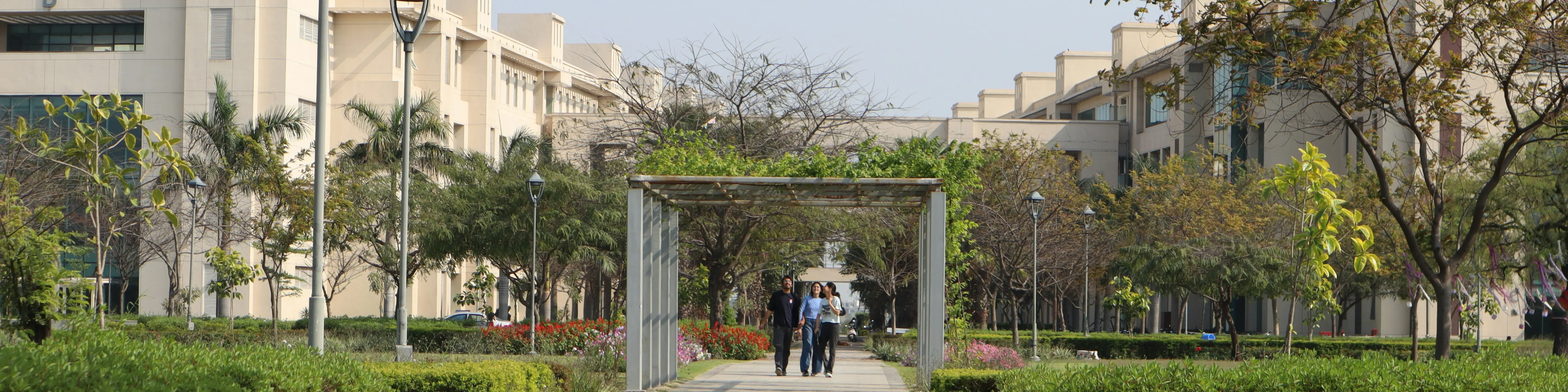
Indian Institute of Remote Sensing provides state-of-the-art infrastructure supporting remote sensing education and research in the serene Dehradun campus.
Institute houses advanced Satellite Image Processing Lab, GIS labs, and Photogrammetry centers with high-end computing systems.
Campus offers comfortable student hostels, faculty residences, and recreational spaces blending modern and traditional architecture.
Features satellite data reception station, libraries, sports facilities, and video conferencing via NKN and ISRO networks.
Indian Institute of Remote Sensing FAQs
What courses does the Indian Institute of Remote Sensing offer?
Indian Institute of Remote Sensing offers M.Tech in Remote Sensing, M.Sc. in Geoinformatics, PG Diplomas in RS & GIS, and short-term certificate courses ranging 1 week to 2 years for professionals and graduates focusing on geospatial technologies and applications.
What is eligibility for PG programs at Indian Institute of Remote Sensing?
For M.Tech/M.Sc./PG Diploma at Indian Institute of Remote Sensing, candidates need B.E./B.Tech/B.Sc./M.Sc. in relevant fields like Physics, Geography, or Computer Science with a minimum 55% aggregate (50% for SC/ST categories) from recognized universities.
How does selection work for admissions at Indian Institute of Remote Sensing?
Selection at Indian Institute of Remote Sensing involves GATE for M.Tech, IIRS Entrance Test for M.Sc./PG Diploma followed by interviews; certificate courses merit-based, with exemptions for government-sponsored and foreign applicants via online interviews.
Does Indian Institute of Remote Sensing provide hostel facilities?
Yes, Indian Institute of Remote Sensing offers on-campus residential blocks for students and faculty with modern amenities in a 556-acre serene campus near Himalayas, ensuring comfortable stay during 1-2 year programs.
Is Indian Institute of Remote Sensing under ISRO?
Yes, Indian Institute of Remote Sensing established in 1966 functions under Department of Space, ISRO as premier institute for remote sensing training, research, and education in Dehradun, Uttarakhand.
What facilities support research at Indian Institute of Remote Sensing?
Indian Institute of Remote Sensing equips labs for image processing, GIS, photogrammetry, big data analytics, satellite reception, high-performance servers, GPS tools, and libraries aiding natural resources, disaster management studies.
Can foreign students apply to Indian Institute of Remote Sensing?
Yes, foreign students can apply to Indian Institute of Remote Sensing for PG programs; exempted from entrance tests but require online interviews, with dedicated seats and support via international collaborations like CSSTE-AP.
What is the location advantage of the Indian Institute of Remote Sensing?
Nestled in Dehradun, Uttarakhand amid Himalayas, Indian Institute of Remote Sensing benefits from a serene environment ideal for geospatial studies, proximity to natural terrains for field applications in remote sensing and earth observation.